Area guides
Forest of Bowland walks: Lancashire's quiet hills
15 October 2026 · 5 min read · Your Next Walk
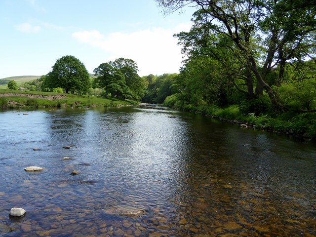
Squeezed between the Lake District, the Yorkshire Dales and the M6, the Forest of Bowland gets overlooked by almost everyone driving past. That's a shame for them and good news for you.
Despite the name, it isn't much of a forest. "Forest" here means an old royal hunting ground, and today Bowland is a landscape of open heather moorland, deep wooded river valleys and stone villages. It's protected as a National Landscape (formerly an Area of Outstanding Natural Beauty), and its emblem is the hen harrier, one of England's rarest birds of prey.
What it doesn't have is crowds. On a sunny Sunday when Windermere is gridlocked, you can walk for hours in Bowland and meet a handful of people.
Getting there
Bowland sits in north Lancashire, with a corner reaching into North Yorkshire. Clitheroe, on the southern edge, has a railway station, and Lancaster, to the north-west, is on the West Coast Main Line. Public transport inside Bowland itself is very limited, so most visitors drive. The roads are narrow and winding, especially the famous Trough of Bowland pass, so allow more time than the map suggests.
Five of the best Forest of Bowland walks
1. Dunsop Bridge and the River Hodder
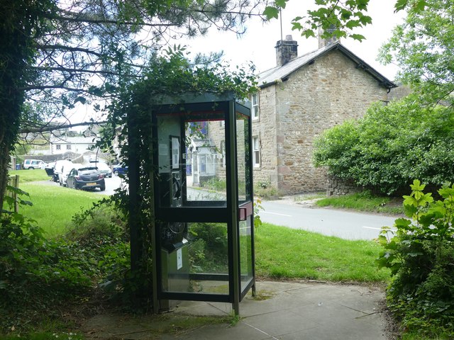 Photo: © Graham Hogg (CC BY-SA 2.0), via Geograph
Dunsop Bridge is a tiny village where the River Dunsop meets the River Hodder, and it's officially the nearest village to the geographic centre of Great Britain, as calculated by Ordnance Survey. A BT phone box on the green marks the claim, with a plaque unveiled by the explorer Sir Ranulph Fiennes.
A short loop follows the River Hodder out of the village and crosses it on a Victorian iron footbridge before returning across the fields. Look out for kingfishers along the river.
2. Dunsop valley to the centre of Great Britain
The village is near the centre of Great Britain, but the actual point is out on a remote hillside at Whitendale Hanging Stones. A track runs north from Dunsop Bridge up the Dunsop valley to the farm hamlet of Whitendale, and from there you can head up onto the fell to reach the exact spot.
It's a proper adventure: remote, exposed and boggy in places, with no facilities once you leave the village. Take a map and a compass or a downloaded route, and save it for a clear day.
3. Beacon Fell Country Park
On the south-western edge of Bowland, Beacon Fell is an isolated hill rising to 266 metres, with woodland, moorland and waymarked trails all within a compact country park. It opened as a country park in 1970, one of the oldest in England.
The summit trail climbs to the trig point, with views across the Lancashire Plain to the coast and north to the Bowland fells. A sculpture trail of carved wooden animals winds through the woods, which makes it a great walk for children, and there are orienteering courses too.
4. Clougha Pike
Clougha Pike is the westernmost summit of the Bowland fells, standing above Quernmore just outside Lancaster. It isn't especially high, but because it's on the edge of the hills, the view from the top is enormous: across Morecambe Bay to the Lake District fells on a clear day.
The usual approach is from the Birk Bank car park, climbing across open access moorland to the rocky summit. Near the top, look for the stone chambers built by the land artist Andy Goldsworthy.
5. Whitewell and the Hodder valley
The Hodder valley around Whitewell is Bowland at its most lush: wooded riverbanks, limestone knolls and green pastures. Riverside paths and quiet lanes link Whitewell with the nearby villages, making it easy to build a loop of whatever length suits.
Tips for walking in the Forest of Bowland
Plan your own Forest of Bowland walk
Tell Your Next Walk how long you want to walk, your ability and the kind of terrain you enjoy, add a pub lunch or café stop if you like, and it'll plan four personalised Forest of Bowland walks on public paths, with step-by-step directions and OS mapping.